
最新更新

|
 党课:讲好抗战故事,把伟大抗战精神一代代传下去——党员教育培训讲稿

|

|

|

|

|

|

|

|
 从抗战精神中汲取推进民族复兴的不竭动力——纪念中国人民抗日战争胜利80周年PPT课件

|
DOC文档

|

|

|

|

|

|

|

|

|

|
PPT文档

|

|

|

|

|

|

|

|

|

|
RAR文档
|
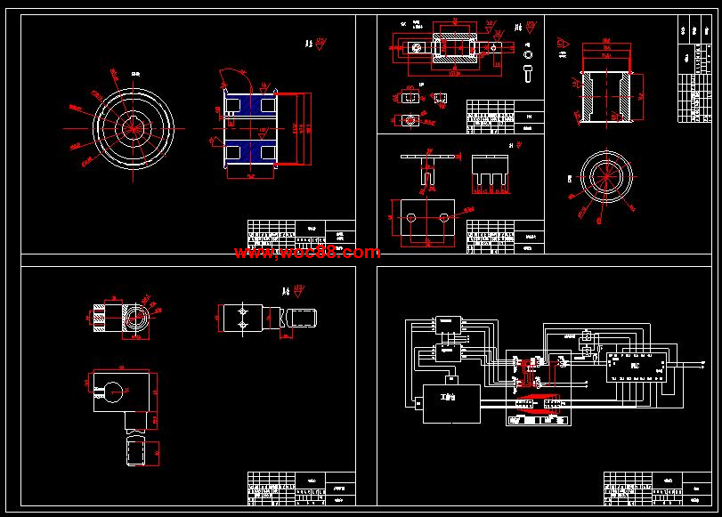
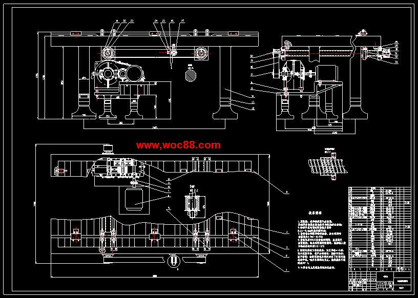
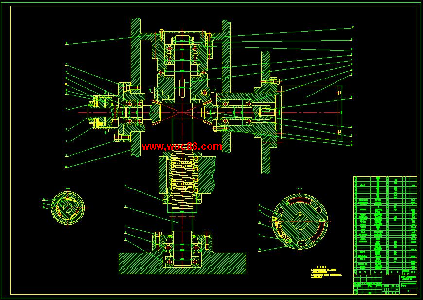
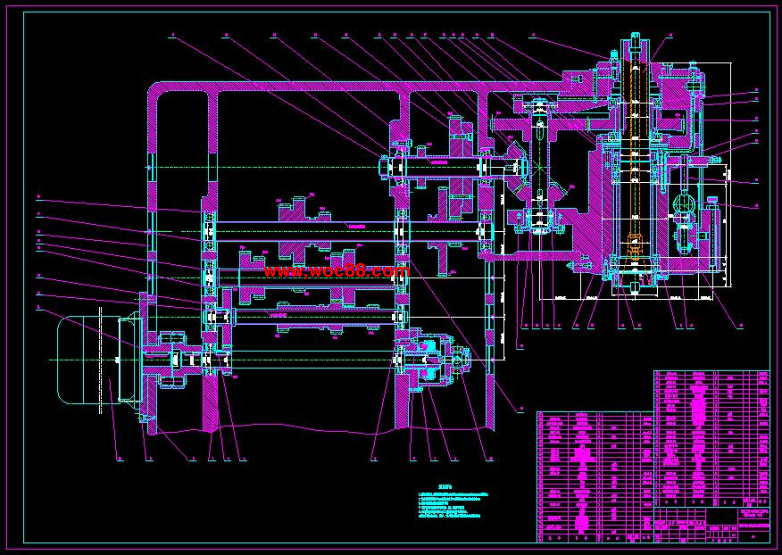
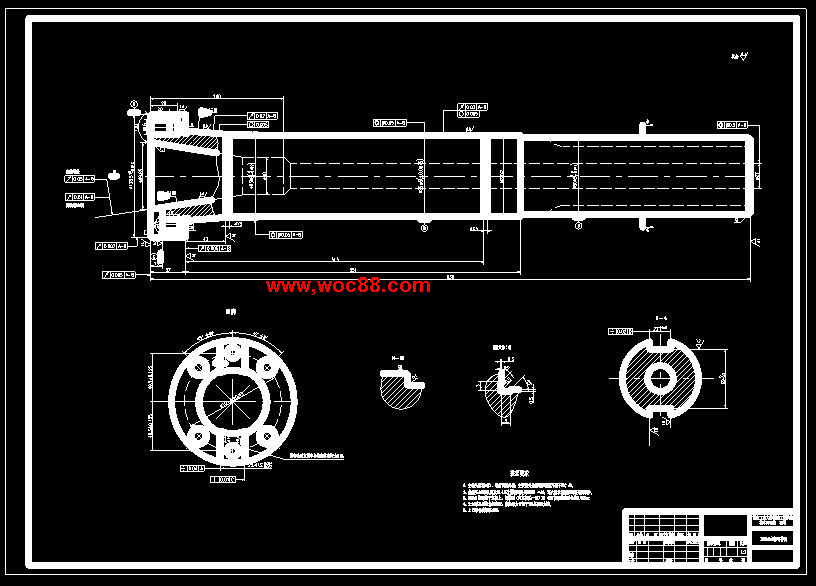
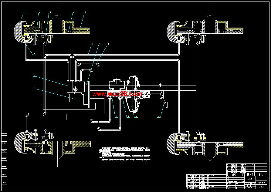
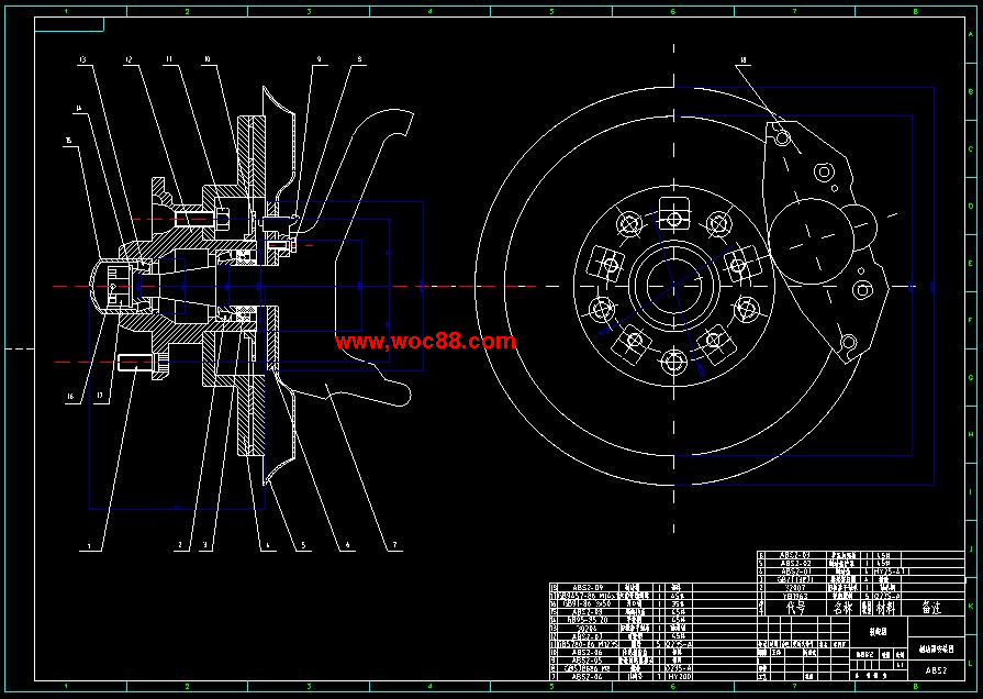
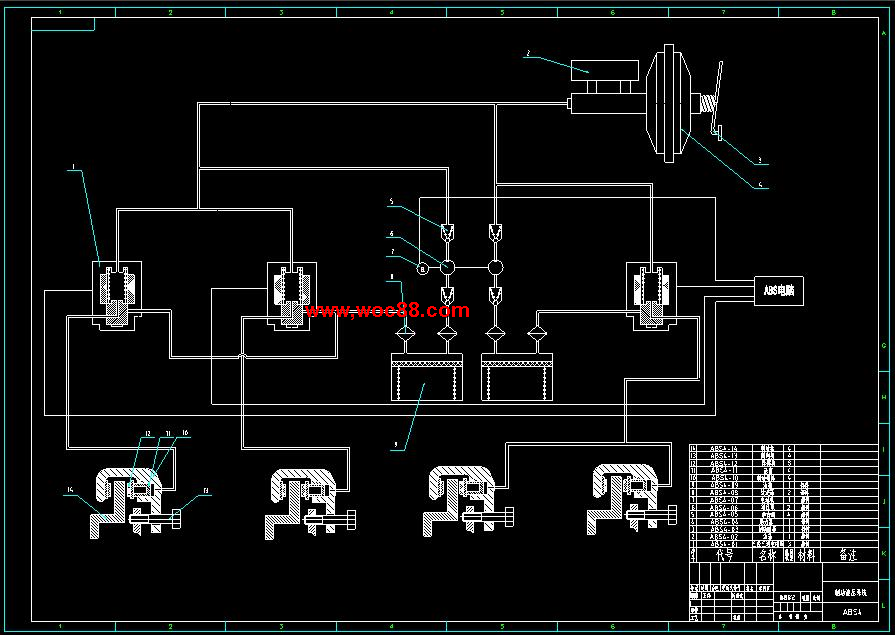
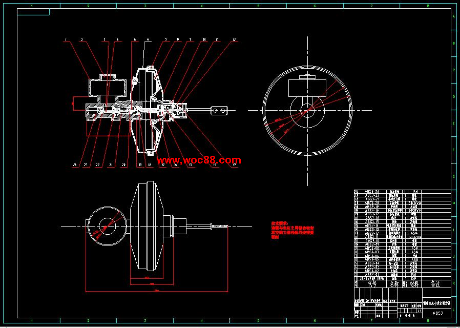
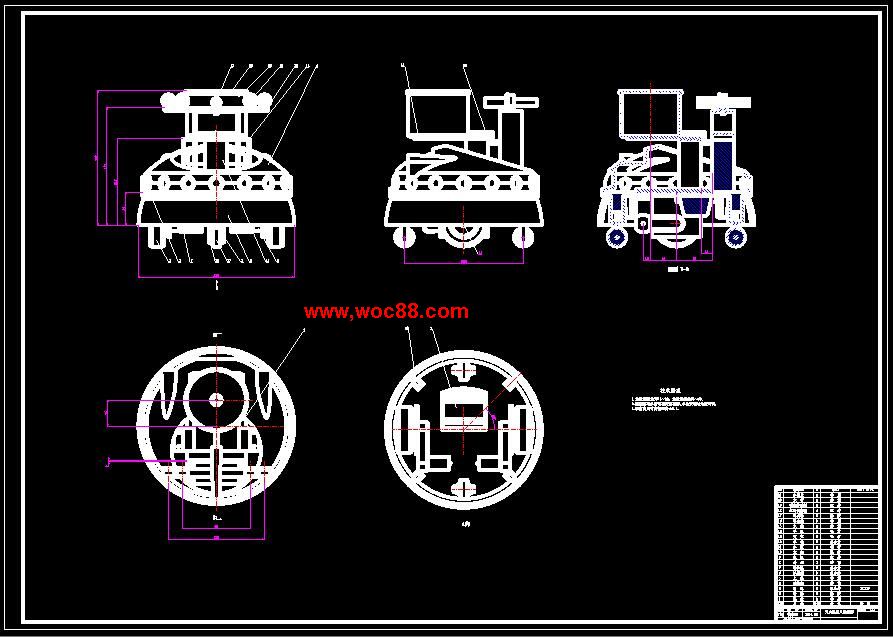
 (毕业设计图纸全套)气雾冷却设备的设计(含说明书)
|
|
|
|
|
|
|
|
|